Google Street View As Fast As Possible
0 up · 0 down · 0 ratings
Description
Google's Street View project has provided us with extensive glimpses of places both far away and close to home. Learn all about the history and tech behind it. Freshbooks message: Head over to freshbooks.com and don’t forget to enter Tech Quickie in the “How Did You Hear About Us” section when signing up for your free trial. Follow: twitter.com Join the community: linustechtips.com License for images used in this video: creativecommons.org
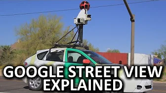
Google Street View As Fast As Possible dives into the history and technology behind Google Street View, tracing its origins from a simple car-mounted camera setup to the modern, multi-faceted imaging platform. The video describes how Google initially partnered with Immersive Media to deploy a 12-sided camera system that could capture expansive street-level views while the vehicle moved, and how Google soon developed its own sphere-like cameras housing multiple lenses to record 360-degree panoramas. It highlights the importance of reliability in harsh environments, noting that the cameras are built with no moving parts and incorporate lasers to help create 3D environment models. The narrative explains the stitching process that combines individual lens images into seamless panoramic images, and it acknowledges occasional stitching errors that produce odd artifacts such as partially cut signs or misaligned figures. Beyond cars, the video covers how Google expanded Street View with backpacks, trolleys, tricycles, and even snowmobiles to access hard-to-reach places, underscoring the project’s global growth to over 80 countries and dependencies and the ongoing user contributions that enrich the library of imagery. The segment concludes by describing how Street View has integrated with Cardboard for virtual reality experiences, enabling users to explore distant locations from a smartphone, while also addressing ongoing privacy concerns and the blurred faces and license plates policy, which aims to blur sensitive details while acknowledging the public nature of street photography. The overall takeaway is that Street View has evolved from a niche urban project to a versatile, widely accessible tool for exploration, while balancing public accessibility with privacy safeguards and real-world use cases like planning travel, auditing neighborhood changes, and supporting small businesses with visual presence.
Topics · technology · privacy · history · virtual reality · geospatial
Questions answered
- What hardware did Google originally use for Street View and how did it evolve?
- Google initially used a car-mounted 12-sided camera system and later developed spherical cameras with multiple external lenses to capture 360-degree views, enabling seamless stitching into panoramic images.
- How does Street View address privacy concerns while remaining useful?
- Street View applies blurring of faces and license plates to protect privacy, while continuing to expand coverage and allow user submissions in areas not yet photographed.
- What are some non-car methods Street View uses to reach difficult locations?
- In addition to cars, Google uses backpacks with cameras, trolleys for indoor spaces like museums, tricycles for narrow streets, and snowmobiles for winter environments.